Tag: guides

  • Master Surpac Drafting Function: A Complete Guide

    Master Surpac Drafting Function: A Complete Guide

    Drafting plays a critical role in modern geological modeling and mine planning. GEOVIA Surpac’s drafting function is a precise and user-friendly feature tailored for professionals who need to digitize and edit points, lines, and planes with accuracy. This article will provide an in-depth exploration of the Surpac Drafting Function, covering its tools, features, and relevant concepts to enhance understanding and usability.


    What is the Drafting Function in Surpac?

    The drafting function in Surpac is a mode designed to enable users to digitize with precision at specific angles or distances from existing points, lines, or objects. It is a pivotal feature for geological mapping, ensuring accuracy in defining locations and measurements. Surpac allows drafting on active planes, supporting both 2D and 3D modeling.


    How to Start Drafting Mode in Surpac

    Getting started with drafting mode in Surpac is straightforward. You can initiate it using any of these methods:

    1. Keyboard Shortcut: Press the number key 5.
    2. Context Menu: Right-click in the graphics area and select “Drafting” from the menu.
    3. Toolbar Access: On the “Digitize” toolbar, click the mode button and select “Drafting.”

    Key Features of Surpac Drafting Function

    Tool Properties Pane

    Upon entering drafting mode, the tool properties pane appears, allowing users to set snapping options and customize their drafting experience:

    1. Angle Snap: Enables points to snap to a specific angular interval, such as 5 degrees.
    2. Distance Snap: Ensures new points align to defined distances, such as 10 units.
    3. Offset Snap: In edge-follow mode, this determines the distance between an existing line and the new point created.

    Edge Follow Mode

    The Edge Follow Mode allows users to trace existing lines seamlessly. This is particularly effective for 2D drafting but also functional in 3D when the planes align.

    • Usage: Activate by holding CTRL and clicking an existing line.
    • Benefit: Facilitates smooth alignment and spacing when drafting near or along edges.

    Status Bar Integration

    While digitizing, the status bar displays real-time data:

    • Distance: From the selected point to the cursor.
    • Bearing: The angular direction.
    • Dip: Indicates the vertical angle between the point and the line.

    Drafting on Planes: A Detailed Look

    Drafting in Surpac occurs on active planes, where angles and distances are contextual to the plane’s orientation. This approach ensures accuracy in representing spatial relationships in both two-dimensional and three-dimensional environments.

    • 2D Plane Mode: Ideal for horizontal mapping.
    • 3D Plane Mode: Useful for inclined or complex geological formations.

    Customizing Drafting Settings

    Surpac allows users to adjust drafting settings for enhanced functionality. These options are accessible through the “Graphics > Tool Settings” menu:

    • Font Size: Adjust the visibility of text for angle and distance indicators.
    • Line Colors: Customize colors for clarity and differentiation.
    • Reference Lines: Define angular measurements relative to horizontal or vertical planes.

    Practical Applications of the Drafting Function

    Geological Mapping

    Drafting facilitates the creation of accurate geological maps by enabling the precise placement of features and boundaries.

    Mine Planning

    In mine design, drafting is essential for defining tunnels, slopes, and benches with specific angles and distances.

    Surveying and Data Validation

    Surveyors use the drafting function to validate and align new data points with existing geological models.


    Benefits of Using Surpac Drafting Function

    • Precision: Ensures accurate placement of points and lines.
    • Efficiency: Reduces manual errors through snapping and predefined intervals.
    • Flexibility: Supports both 2D and 3D modeling environments.
    • Ease of Use: Intuitive interface with helpful tooltips and status bar feedback.

    Tips for Optimizing the Surpac Drafting Function

    1. Familiarize with Snapping Options: Adjust angle, distance, and offset snaps to suit your project needs.
    2. Use Edge Follow Mode for Curves: Ensure smooth tracing of complex shapes.
    3. Leverage Default Settings: Customize frequently used options like colors and fonts for a personalized experience.
    4. Utilize the Status Bar: Monitor real-time measurements to ensure alignment with project specifications.

    Conclusion

    The Surpac Drafting Function is an indispensable tool for professionals in geology and mine planning. Its advanced features, such as snapping intervals, edge-follow mode, and customizable settings, empower users to draft with unparalleled accuracy and efficiency. Whether you’re mapping geological formations or designing intricate mining layouts, mastering Surpac’s drafting capabilities will significantly enhance your workflow.

    Embrace the Surpac Drafting Function to achieve precision and efficiency in all your geological and mining endeavors

  • Mastering Range in Surpac: Guide to Applications & Best Practices

    Mastering Range in Surpac: Guide to Applications & Best Practices

    Introduction: What is a Range in Surpac?

    In GEOVIA Surpac, a “range” is a way to define and control the display of specific data within a dataset, such as strings, segments, solids, and surfaces. It allows users to focus on particular subsets of data, simplifying tasks like visualization, analysis, and editing. Ranges act as filters that help users streamline their workflows when dealing with large or complex data files.

    The Importance of Ranges in Surpac

    The range in Surpac is essential for mining and geological modeling because it allows for efficient management of vast amounts of data. By defining a range, you can isolate specific features, structures, or areas within a dataset. For example:

    • String numbers can represent different physical zones or features.
    • Object numbers or trisolations can define parts of a solid or surface.

    Understanding Range Syntax in Surpac

    The syntax used for ranges in Surpac is straightforward and highly flexible. It allows for various combinations of data selection, including continuous sequences, incremental values, and even irregularly spaced numbers.

    Here’s a breakdown of the commonly used syntax:

    1. Single Number: 7
      • Displays only the data associated with number 7.
    2. Continuous Range: 1,8
      • Displays all numbers from 1 to 8, i.e., 1, 2, 3, …, 8.
    3. Incremental Range: 1,10,2
      • Displays numbers from 1 to 10 with an increment of 2, i.e., 1, 3, 5, …, 9.
    4. Decreasing Range: 150,120,-10
      • Displays numbers from 150 down to 120, decrementing by 10, i.e., 150, 140, 130, …, 120.
    5. Irregular Values: 4200;4225
      • Displays specific values (4200 and 4225) without anything in between.
    6. Combination of Ranges: 1,5;23
      • Displays numbers 1 to 5 and 23, i.e., 1, 2, 3, 4, 5, 23.
    7. Using Range Files: @<rangefile>
      • Loads predefined ranges from a file, e.g., @pitcrests.

    Range Files in Surpac

    To save time and avoid repeated typing, Surpac allows users to store ranges in range files with a .rng extension. These files follow a simple format:

    • Begin with START RANGE.
    • End with END RANGE.
    • Include range values between these markers.

    Applications of Range in Surpac

    1. Visualization: Display specific subsets of data, such as selected string numbers or specific surfaces.
    2. Editing: Focus on particular data points for targeted modifications.
    3. Analysis: Analyze specific zones or features without cluttering the workspace.
    4. Modeling: Use ranges to define regions for solid or surface modeling.

    Tips and Best Practices for Working with Ranges in Surpac

    1. Plan Your Ranges: Before starting a project, plan which ranges will be needed for efficient organization and analysis.
    2. Keep Range Files Handy: Save commonly used ranges in .rng files for quick access.
    3. Combine Ranges: Use combinations of regularly spaced and irregularly spaced values for flexibility.
    4. Stay Within Character Limits: Range fields have a limit of 128 characters, so for complex ranges, use range files without character limits.

    Advanced Use Cases of Ranges

    • Crest Design in Mining: Use decreasing ranges (e.g., 150,120,-10) to model pit crests effectively.
    • Complex Geometries: Combine multiple range types to handle intricate geological structures.
    • Automation: Incorporate ranges into scripts for automated tasks, keeping in mind the 128-character limit in scripts.

    Conclusion: The Power of Ranges in Surpac

    The range in Surpac is a powerful feature that enables users to manage and manipulate data efficiently. By mastering range syntax and leveraging range files, users can enhance productivity and ensure more organized and streamlined workflows. Whether you are a geologist, engineer, or data analyst, understanding ranges is fundamental to unlocking Surpac’s full potential.

  • Comprehensive Guide to the Concepts of Strings in Surpac

    Comprehensive Guide to the Concepts of Strings in Surpac

    Strings in Surpac play a foundational role in representing and analyzing three-dimensional spatial data. They are essential for modeling, surveying, and engineering tasks within the software. Below, we dive deep into the topic, covering all aspects of strings in Surpac.


    What is Strings in Surpac?

    A string in Surpac is a series of three-dimensional coordinates representing physical features. Just as lines and shapes define objects in a sketch, strings delineate essential aspects of geological and engineering models. For example, strings can represent the crest and toe of a mine bench, geological boundaries, road edges, and more.


    Classification of Strings In Surpac

    Strings in Surpac are classified into three primary types:

    1. Open Strings:
      These are unclosed lines, either straight or curved. If multiple open strings share the same string number, they are divided into “open segments” and assigned segment numbers.
      Example: Lines outlining a section of a road.
    2. Closed Strings:
      These form closed loops, such as circles or polygons, where the first and last coordinates are identical. Multiple closed strings sharing the same number are categorized as “closed segments.”
      Example: Contour lines of a specific elevation on a topographic map.
    3. Spot Height Strings:
      These are sets of random points with no discernible feature or order. They are commonly used for elevation data or borehole coordinates.
      Example: Elevation points scattered across a surface.

    String Numbering and Purpose

    Each string is assigned a unique string number ranging from 1 to 32,000. These numbers can either:

    • Serve as identifiers with no inherent significance (e.g., in surveying), or
    • Encode the purpose of the string (e.g., identifying a boundary string or geological feature).

    Understanding String Directions in Surpac

    • The order of points in a string determines its direction:
      • Clockwise Closed Strings: Represent positive (inclusive) areas.
      • Anticlockwise Closed Strings: Represent negative (exclusive) areas.
    • Nested closed strings (e.g., a clockwise string containing an anticlockwise string) define the area between them.
      • Example:
        • Area 1 (Clockwise): +300
        • Area 2 (Anticlockwise): -100
        • Total Area: 300 – 100 = 200

    Description Fields in Strings

    Each point in a string can have associated descriptive data, referred to as point descriptions. These are typically attributes or metadata related to the feature. For example:

    • A survey station’s name.
    • Attributes such as water sample concentration and salinity.

    Descriptions can be divided into up to 100 sub-fields (D1 to D100), separated by commas.
    Example:
    Description = "TREE, 1.54, HOUSE"

    • D1 = TREE
    • D2 = 1.54
    • D3 = HOUSE

    The total description field length must not exceed 512 characters.


    String File Formats

    Strings are stored in string files (with .str extension), which are plain-text ASCII files containing structured data. Each string file comprises:

    1. Header Record: General file details like the date and purpose.
    2. Axis Record: Defines a 3D axis used for sectional analysis.
    3. String Records: Coordinates and descriptions of the points making up the strings.

    Each string file can contain up to 32,000 different strings.


    String Data Ranges and Numbers

    • String Numbers: Identify and group strings, ranging from 1 to 32,000.
    • Data Ranges: Can denote specific features or categories, such as contours, boreholes, or geological zones.

    Naming Conventions for String Files

    String files follow a two-part naming system:

    1. Location Code: A short identifier indicating the file’s content (e.g., SAL for salinity data).
    2. ID Number: A numeric identifier, often indicating a sequence or timestamp.

    Example:

    • SAL9001 (Location: SAL, Year/Month: 1990/01)

    Units of Measurement

    • Surpac treats all data as unitless to ensure consistency within a project.
    • Users must ensure all measurements are in compatible units, whether in metric (meters, ppm) or imperial (feet, ounces).
    • Plotting Module Exception: When entering scale, units depend on whether metric or imperial settings are used.
      • Metric: A scale of 1000 means 1mm = 1m.
      • Imperial: A scale of 200 means 1 inch = 200 feet.
    • Angles can be specified in degrees or grads (centesimal), with formats like DDD.MMSS or DDD.DDDD for decimal degrees.

    String Types in Practice

    • Survey Applications: Often use open strings for features like pit boundaries.
    • Engineering and Geological Applications: Focus on closed strings for defining volumes, areas, and bench crests/toes.

    File Extensions Related to Strings in surpac

    • .str: Stores string data.
    • .obs: Contains raw observations or imported external data.

    String Directions and Volume Calculation

    • Closed string directionality is critical for area and volume calculations.
    • By convention:
      • Clockwise: Positive area.
      • Anticlockwise: Negative area.

    Visualization:

    Typical configurations:

    • Y (Northing), X (Easting), Z (Elevation).

    Applications of Strings in Modeling

    Strings are vital in creating models like:

    • Open pits: Strings represent mid-bench contours.
    • Geological zones: Boundaries are defined with strings.

    These models can be intersected using Surpac tools to analyze relationships between different datasets (e.g., aquifer zones within a pit).


    Key Takeaways

    Strings in Surpac offer a versatile and powerful way to represent and analyze spatial data, from simple survey lines to complex geological models.

  • What Are DTMs? DTM Concepts In Surpac

    What Are DTMs? DTM Concepts In Surpac

    Surpac, is a comprehensive geology and mine planning software used widely in the mining and exploration industry. One of its core concepts is DTM (Digital Terrain Model), which is essential for modeling surfaces, volumes, and geological features. Here’s an in-depth explanation of DTM concepts in Surpac.

    What is a DTM (Digital Terrain Model)?

    A Digital Terrain Model (DTM) is a mathematical representation of the Earth’s surface, terrain, or other spatial surfaces in 3D. In mining, geology, and civil engineering software like Surpac.

    Key Characteristics of a DTM

    1. 3D Representation: DTMs provide a 3D view of a surface, including elevations, to accurately model topography and other spatial features.
    2. Triangulation: The surface is built using a network of triangles, created by connecting 3D points (vertices).
    3. Surface Modeling: Used to model both natural and artificial surfaces, such as:
      • Land topography
      • Pit designs
      • Waste dumps
      • Underground structures

    How DTMs Work

    1. Input Data: A DTM is created using spatial data, such as survey points, polylines, or contours.
    2. Triangulation: The software connects these points into a triangular network using a Triangulated Irregular Network (TIN) method.
    3. Surface Generation: The resulting surface represents the terrain or feature of interest.

    Benefits of Using DTMs

    1. Accurate Representation: DTMs provide precise spatial information about surfaces.
    2. Analysis: Enable volume calculations, slope analysis, and visualization.
    3. Efficiency: Automated tools streamline the creation and manipulation of surfaces.

    Challenges

    1. Data Quality: Inaccurate or sparse input data can lead to errors in the DTM.
    2. Complexity: Modeling highly detailed or intricate surfaces requires advanced tools.
    3. Validation: Ensuring the model is error-free (e.g., no duplicate points or dangling edges).

    Here are some deep dive into the DTM concepts in Surpac related field.

    1. DTM Concepts in Surpac

    A DTM (Digital Terrain Model) is a triangulated surface representation of spatial data, typically used to model terrain or geological surfaces. It consists of a network of triangles that are formed by connecting points and lines in 3D space. These models are fundamental for representing the topography of land, ore bodies, pit designs, and more.


    2. Components of a DTM

    A DTM in Surpac is composed of:

    • Vertices (Points): 3D points with X, Y, Z coordinates.
    • Edges (Lines): Straight lines connecting the vertices.
    • Triangles (Faces): Triangular facets formed by connecting three points.

    3. Types of DTM Surfaces in Surpac

    • Topographical Surface: Represents the natural ground surface.
    • Pit or Dump Surface: Created to represent mining pits, waste dumps, or stockpiles.
    • Geological Surfaces: Used to model strata, faults, or ore body outlines.
    • Underground Surfaces: Represent underground workings like drifts and stopes.

    4. How to Create a DTM in Surpac

    A DTM can be created using the following methods:

    1. From Points:
      • Select a set of 3D points with X, Y, Z coordinates.
      • Use the “Create DTM from points” tool in Surpac.
    2. From Polylines:
      • Use closed or open polylines to form triangulated surfaces.
    3. From Data Files:
      • Import external data (e.g., CSV, DXF) and use it to create DTMs.
    4. From Multiple Surfaces:
      • Combine two or more DTMs into a single DTM by merging or clipping.

    5. DTM Operations in Surpac

    Surpac allows a variety of operations on DTMs:

    • Editing: Modify existing triangles, add or remove vertices, adjust elevations, etc.
    • Merging: Combine two or more DTMs into one.
    • Clipping: Trim or split a DTM using boundaries or other DTMs.
    • Validation: Check for errors like duplicate points, dangling edges, or inconsistent normals.
    • Calculation: Compute volumes, areas, or generate contours.
    • Smoothing: Improve the visual and analytical quality of a DTM.

    6. Applications of DTMs in Surpac

    DTMs are central to many workflows in Surpac, such as:

    • Surveying: Modeling topography and terrain changes.
    • Mine Design: Creating pit shells, waste dumps, and underground layouts.
    • Geological Modeling: Representing ore body geometry or fault planes.
    • Volume Calculations: Estimating material quantities for pits, dumps, and stockpiles.
    • Analysis and Visualization: Rendering realistic 3D views of terrain and geological features.

    7. Best Practices for Working with DTMs

    • Ensure Data Quality: Use accurate and dense point data to create DTMs.
    • Validate DTMs Regularly: Check for errors and inconsistencies after creation or editing.
    • Use Appropriate Boundaries: Define clear limits when creating or clipping DTMs.
    • Maintain Proper Layering: Organize DTMs into layers for efficient management.

    8. Tools and Functions Related to DTMs in Surpac

    Some commonly used tools for DTM management in Surpac include:

    • Create DTM: To generate a new DTM.
    • Edit DTM: For modifying existing DTMs.
    • DTM Calculations: Compute areas, volumes, or intersections.
    • Combine DTMs: Merge, subtract, or intersect multiple DTMs.
    • DTM Validation: Check and fix errors in the model.
    • DTM to Grid Conversion: Convert DTMs to grid files for contouring and other analyses.

    9. Challenges in DTM Handling

    • Data Gaps: Missing or sparse data can lead to inaccurate models.
    • Complex Surfaces: Handling intricate geological structures may require advanced tools.
    • Processing Time: Large datasets can increase computational demands.

    10. Advanced Features

    • Dynamic DTM Updates: Automatically adjust DTMs based on new data.
    • Automated Processes: Use macros or scripts for repetitive tasks.
    • Integration with Other Modules: Combine DTM analysis with block modeling, resource estimation, and other Surpac tools.

    Understanding DTM concepts and tools in Surpac is crucial for effective mine planning and geological analysis.

    References:

    • https://www.slideshare.net/slideshow/1summery/82674725
    • https://ijcrt.org/download1.php?file=IJCRT2202112.pdf
    • https://1library.net/article/dtm-dtm-intersections-surpac-dtm-surface-tutorial.yrgjr88q
    • http://www.surpac.co.za/wp-content/uploads/2019/05/SURPAC-Topographical-Module-Applications.pdf
  • In-Detailed Case Studies Utilizing Surpac and Point Cloud Data

    In-Detailed Case Studies Utilizing Surpac and Point Cloud Data

    Real-Life Project Examples and Case Studies Utilizing Surpac and Point Cloud Data. Here are examples where Surpac played a vital role in processing point cloud data for successful mining and geological projects:


    1. Pilbara Iron Ore Mine, Australia

    Project Overview:

    • Located in Western Australia, this mine required detailed geological modeling, mine planning, and ongoing survey integration for efficient operations.

    Role of Surpac:

    1. Point Cloud Data Integration:
      • High-resolution point cloud data from drones and LiDAR surveys was used to create detailed surface models of the vast mining site.
      • Regular drone surveys provided updates for monitoring pit progress and stockpile volumes.
    2. Open Pit Design:
      • Surpac utilized digital terrain models (DTMs) derived from the point cloud data to design multi-stage open pits.
      • The software optimized pit walls and ramps, ensuring geotechnical stability.
    3. Surveying and Progress Monitoring:
      • Point clouds were integrated with Surpac for comparing the “as-planned” versus “as-built” surfaces.
      • Enabled real-time monitoring of excavation and backfilling operations.

    Outcome:

    • Efficient mine planning and stockpile management.
    • Improved safety and compliance with geotechnical standards.

    2. Oyu Tolgoi Copper-Gold Mine, Mongolia

    Project Overview:

    • One of the world’s largest copper and gold mines, requiring precise underground and surface planning.

    Role of Surpac:

    1. Geological Modeling:
      • Drillhole data and LiDAR-generated point clouds were integrated into Surpac to model the subsurface geology and ore body.
      • This ensured accurate resource estimation and identification of high-grade zones.
    2. Underground Mine Design:
      • Surpac was used to design declines and stopes with precision, leveraging point cloud data for real-world alignment of geological models.
    3. Environmental Planning:
      • High-resolution point clouds were used to plan infrastructure like tailings dams and water management systems.

    Outcome:

    • Accurate design of underground layouts and reduced dilution during mining.
    • Enhanced environmental compliance and optimized land use planning.

    3. Bingham Canyon Copper Mine, USA

    Project Overview:

    • An open-pit mine in Utah, USA, known for its massive scale and continuous operations.

    Role of Surpac:

    1. Pit Slope Stability:
      • Point cloud data from terrestrial LiDAR was integrated into Surpac to monitor pit walls.
      • Surpac analyzed slope changes over time, preventing failures.
    2. Volume and Tonnage Calculation:
      • Monthly drone surveys generated point clouds of stockpiles and excavation zones.
      • Surpac calculated precise volumes for material handling and production reporting.
    3. Life-of-Mine Planning:
      • The software helped in updating mine plans by incorporating real-time survey data into the models.

    Outcome:

    • Improved safety through proactive slope monitoring.
    • Efficient resource allocation and production tracking.

    4. Venetia Diamond Mine, South Africa

    Project Overview:

    • A diamond mine requiring both open-pit and underground mining operations.

    Role of Surpac:

    1. Transition from Open Pit to Underground Mining:
      • Point cloud data from drone and laser scans was processed in Surpac to model the transition zones.
      • Surpac integrated these models for planning underground shaft positions and tunnel networks.
    2. Stockpile and Waste Management:
      • LiDAR-generated point clouds were used to monitor stockpile volumes and optimize waste dump layouts.
    3. Environmental Rehabilitation:
      • Point clouds were used to design post-mining landforms, ensuring compliance with rehabilitation standards.

    Outcome:

    • Seamless transition from surface to underground mining.
    • Effective monitoring of material movement and environmental impact.

    5. Tasiast Gold Mine, Mauritania

    Project Overview:

    • A large gold mine requiring accurate resource modeling and pit design in a remote desert location.

    Role of Surpac:

    1. Desert Topography Mapping:
      • Point cloud data collected by drones was crucial for creating a detailed topographic model in Surpac.
      • The software processed these models for pit design and haul road planning.
    2. Resource Estimation:
      • Integrated point clouds with drillhole data to estimate the gold resource and model high-grade zones.
    3. Operational Efficiency:
      • Used Surpac to track excavation progress and reconcile production with mine plans.

    Outcome:

    • Accurate pit and infrastructure designs, reducing operational costs.
    • Improved resource estimation and production tracking.

    6. Grasberg Copper-Gold Mine, Indonesia

    Project Overview:

    • One of the largest copper and gold mines, transitioning from open-pit to underground operations.

    Role of Surpac:

    1. Subsurface Modeling:
      • LiDAR and point cloud data from underground scans were used to map tunnel networks in Surpac.
      • Helped align planned and actual mining layouts.
    2. Open Pit Monitoring:
      • Regular drone surveys provided point clouds for monitoring pit slope stability.
      • Surpac analyzed these for geotechnical risk assessment.
    3. Underground Design:
      • Integrated 3D laser scan data to optimize stope boundaries and ventilation systems.

    Outcome:

    • Minimized dilution and improved ore recovery in underground operations.
    • Enhanced safety and operational efficiency.

    Summary of Benefits in These Projects

    • Accuracy: Processing point cloud data in Surpac ensures precise geological and mine designs.
    • Efficiency: Automates workflows for resource estimation, design, and monitoring.
    • Real-Time Updates: Allows integration of real-world survey data for dynamic mine planning.
    • Compliance: Ensures alignment with safety and environmental regulations.

    These examples highlight how Surpac, combined with point cloud data, plays a critical role in achieving successful mining and geological outcomes across diverse projects.

    Some More In-Detailed Studies On Case Studies Utilizing Surpac and Point Cloud Data

    Surpac has been integral to many real-world projects, leveraging its ability to process point cloud data for tasks such as mining, construction, and geospatial analysis. Here are a few practical examples and case studies where Surpac played a key role:

    1. Mine Planning and Design: In a gold mine in Western Australia, Surpac was used to process point cloud data collected from drone surveys and laser scanners. These datasets were crucial for creating accurate 3D geological models and designing efficient pit expansions. The use of Surpac minimized the risk of errors and optimized material extraction, saving time and reducing cost.
    2. Infrastructure Rehabilitation: In restoration projects, Surpac processed point cloud data from laser scans to create detailed digital twins of deteriorating structures. These models allowed engineers to plan retrofitting with high precision, eliminating guesswork and reducing invasive surveys​.
    3. BIM Integration in a Mechanical Facility: A mechanical room in Florida was scanned using laser scanning technology, producing a large point cloud dataset of 14.2 GB. The data was processed in software like Surpac and ReCap Pro to create a detailed Building Information Model (BIM). This model provided insights into spatial constraints and was used for retrofitting and system upgrades, enabling smooth integration with Revit.​
    4. Atelier Lumi – Architectural Precision: For a compact architectural project, Surpac processed point cloud data to model intricate details of a small guest house. The precision modeling helped architects plan space usage efficiently while aligning designs with real-world conditions​.

    These examples demonstrate how Surpac’s capabilities in handling point cloud data streamline workflows, improve decision-making, and enhance collaboration across various industries.

    Examples Case Studies Within Asia and India On Case Studies Utilizing Surpac and Point Cloud Data

    In India and Asia, GEOVIA Surpac has played a significant role in various mining projects by efficiently processing point cloud data to enhance geological modeling, mine planning, and resource estimation. Here are two examples of its application:

    1. Stockpile Volume and Tonnage Estimation in India

    A case study at Parameshwari Minerals in India utilized Surpac for the accurate computation of stockpile volumes and tonnage. Survey data captured using total stations and drones was processed in Surpac to generate 3D models of four stockpiles. The software facilitated volume computation by processing Northing, Easting, and Elevation (XYZ) coordinates, and compared results using the Digital Terrain Model (DTM) method. Surpac’s efficiency reduced the time needed for data import, modeling, and computation to just a few minutes per stockpile. This application highlighted its capability to streamline resource management in mining operations.

    2. Iron Ore Resource Modeling in Asia

    Surpac has been extensively used for iron ore reserve estimation in Asia. In one project, point cloud data from drill holes was processed to model geological structures and ore zones. The workflow included digitizing cross-sections, creating triangulated solid models, and calculating volumes of ore zones. Variogram modeling was also employed to assess spatial variability, ensuring precise grade control and resource estimation. This comprehensive modeling enabled mining companies to plan extraction processes with reduced material waste and optimized operational efficiency.

    Benefits and Impact

    These case studies demonstrate how Surpac integrates point cloud data to enhance decision-making, minimize costs, and improve operational accuracy. In India and Asia, such practices are pivotal for managing extensive mineral resources and complying with environmental standards while maximizing economic returns.


    Case Study 1: Stockpile Volume Estimation at Parameshwari Minerals (India)

    Objective:

    The project aimed to estimate the volume and tonnage of multiple stockpiles at a mining site using survey data processed in Surpac.

    Data Collection:

    • Surveyors collected XYZ (Northing, Easting, and Elevation) data points from the stockpiles using total stations and drones.
    • Data was exported as CSV files, containing precise coordinates for surface modeling.

    Process in Surpac:

    1. Data Import: The survey data was imported into Surpac, and point clouds were converted into surface models.
    2. Surface Modeling: Digital Terrain Models (DTMs) were created for both the base and top surfaces of the stockpiles.
    3. Volume Calculation:
      • Surpac’s surface-volume computation tools were used to calculate the stockpile volume between the base and top surfaces.
      • The calculated volume was combined with material density to determine the stockpile’s tonnage.

    Results:

    • The process reduced the time needed for modeling and computation significantly.
    • Stockpile volumes were calculated with high precision, supporting effective inventory management.

    Impact:

    This method provided a reliable and efficient means for resource tracking, offering significant time and cost savings compared to traditional methods.


    Case Study 2: Iron Ore Resource Modeling in Asia

    Objective:

    To model and estimate iron ore reserves using point cloud data from drill hole surveys.

    Data Collection:

    • Drill hole surveys provided geospatial data, including ore grade, lithology, and structural information.

    Process in Surpac:

    1. Geological Modeling:
      • Cross-sections were digitized to delineate ore bodies.
      • Wireframe models of the ore zones were created using Surpac’s triangulation tools.
    2. Block Modeling:
      • Block models were generated to estimate volumes and grades.
      • Variogram analysis was conducted to understand spatial distribution.
    3. Validation:
      • Models were validated using Surpac’s solid and block model validation tools to ensure consistency and accuracy.
    4. Volume and Tonnage Calculation:
      • The validated models were used to calculate ore volumes and tonnages.
      • Variogram models (e.g., spherical and exponential) helped refine resource estimations.

    Results:

    • The project ensured accurate resource estimation with minimal material loss.
    • Enabled the mining company to plan for efficient extraction processes while reducing waste.

    Impact:

    The modeling process streamlined operational planning and provided robust data for regulatory reporting.


    General Benefits of Using Surpac in These Projects:

    • Accuracy: Provides precise volumetrics and grade estimations.
    • Efficiency: Processes point cloud data faster than traditional methods.
    • Scalability: Handles large datasets, ideal for mining and geospatial projects.
    • Compliance: Ensures adherence to international mining standards like JORC and NI 43-101.

    More Examples On Case Studies Utilizing Surpac and Point Cloud Data Within India

    In India, GEOVIA Surpac has been utilized in several mining projects where point cloud data integration has enhanced geological modeling, resource estimation, and mine planning. Here are some notable applications:

    1. Resource Estimation and Mine Design at Kudremukh Iron Ore Company Limited (KIOCL): Surpac has been used for integrating point cloud data from drone and LIDAR surveys to refine topographical models and enhance ore block modeling. This approach ensures better resource allocation and environmental compliance in open-pit mining scenarios
    2. Coal Mining in Central India: In the coal-rich regions, including areas under Coal India Limited, Surpac has been applied for block modeling and reserve estimation. Point cloud data from laser scanning has been integrated to provide accurate terrain models, enabling efficient pit design and operational planning.
    3. Manganese Mining in Odisha: In Odisha, Surpac has been deployed for analyzing point cloud data derived from drone surveys for manganese ore bodies. The software has enabled accurate volume calculations and improved excavation planning, ensuring minimal material wastage and better recovery rates.
    4. Geotechnical Analysis in Zinc Mining by Hindustan Zinc Limited: In underground zinc mines, Surpac has been utilized for stope optimization, incorporating structural analysis of point cloud data from photogrammetry and underground LIDAR scans. This has led to safer mining operations and maximized ore recovery.
    5. Iron Ore Mining in Goa: Companies in Goa have used Surpac for reconciliation of ore mined versus the planned production using point cloud-based topographical changes. This has enhanced the accountability and accuracy of production reporting.

    These projects highlight the versatility of Surpac in handling diverse geological conditions and its effectiveness in integrating modern surveying techniques such as point cloud data from drones and LIDAR. These innovations are paving the way for more efficient and environmentally conscious mining operations in India.

    References:

    • https://www.irjet.net/archives/V8/i11/IRJET-V8I1132.pdf
    • https://www.slideshare.net/slideshow/resource-estimation-using-surpac-software-in-mining/247948956
    • https://www.ryanus.com/geovia-surpac
    • https://www.archdaily.com/1012723/navigating-3d-scanning-and-point-clouds-theory-practice-and-real-world-applications
    • https://www.united-bim.com/walk-through-of-point-cloud-to-bim-process/


  • Point Cloud Data From Drone & Its Uses In Surpac

    Point Cloud Data From Drone & Its Uses In Surpac

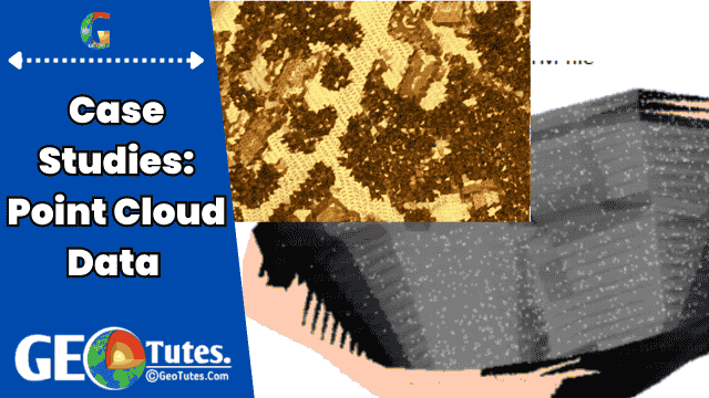
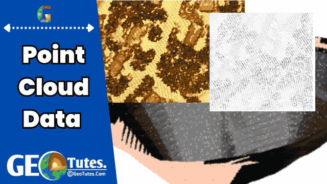
    Point cloud data is a collection of data points in 3D space, where each point represents a location and often includes additional attributes like color, intensity, or classification. It is primarily used to represent the surface of an object or a site in a digital format.

    Point cloud data is typically generated using:

    1. Drone Surveys: Drones equipped with cameras and/or LiDAR (Light Detection and Ranging) sensors capture data from aerial perspectives. This data is processed to create 3D models of terrains, structures, or objects.
    2. 3D Laser Scanning (LiDAR): A terrestrial or aerial LiDAR system emits laser pulses and measures the time it takes for the pulse to return after hitting a surface. This method provides highly accurate and dense 3D data of the surveyed area.

    Drone Surveys for Point Cloud Data

    1. How it works:
      • Image Capture: Drones equipped with high-resolution cameras or LiDAR sensors capture images or laser reflections of the terrain from multiple angles.
      • Data Processing: Software such as Pix4D or Agisoft Metashape processes these images to generate dense point clouds using photogrammetry techniques.
      • Applications: Drone surveys are commonly used for large areas, topographic mapping, volume calculations, and monitoring changes over time.
    2. Advantages:
      • Cost-effective for large-scale surveys.
      • Quick data acquisition over difficult terrains.
      • High-resolution imagery and accurate 3D models.

    3D Laser Surveys for Point Cloud Data

    1. How it works:
      • A LiDAR device emits thousands of laser pulses per second.
      • It records the time taken for each pulse to return, calculating the distance and thus creating a 3D representation of the surveyed area.
    2. Advantages:
      • Exceptional accuracy and detail, even for small features.
      • Effective in low-visibility environments (e.g., forests or underground).
    3. Applications:
      • Used for structural mapping, underground surveys, and areas requiring extreme precision.

    Integration of Point Cloud Data in Surpac

    Surpac is a geological modeling and mine planning software used in the mining industry. It supports point cloud data integration for:

    1. Topographic Modeling:
      • Point cloud data can be imported into Surpac to create accurate digital elevation models (DEMs) and contour maps.
      • These models are crucial for surface mine planning and infrastructure development.
    2. Volume Calculations:
      • Surpac can use the 3D models generated from point clouds to calculate volumes of stockpiles, pits, or material.
    3. Surveying and Design:
      • Point clouds provide an accurate representation of existing conditions, which helps in designing mine layouts, tunnels, and other infrastructure.
    4. Data Validation:
      • It allows comparison of as-built versus design models to monitor progress and ensure accuracy in excavation or construction.

    Benefits of Using Point Cloud Data in Surpac

    • Accuracy: High-precision models lead to better decision-making in resource estimation and planning.
    • Efficiency: Automates the integration of complex survey data, reducing manual work.
    • Visualization: Allows 3D visualization of the terrain and subsurface structures for improved understanding and communication.

    Challenges and Considerations

    • Large Data Sizes: Point clouds can be extremely large, requiring robust processing and storage solutions.
    • Software Compatibility: Ensuring that point cloud data formats (e.g., LAS, PLY) are compatible with Surpac.
    • Expertise Required: Proper training is necessary to process point clouds and integrate them effectively.

    Application Of Point Cloud Data in Surpac Software

    Surpac is a widely used geological modeling and mine planning software, primarily employed in the mining and exploration industries. It supports various workflows for geological analysis, mine planning, and resource estimation. Here’s an overview of the key processes carried out in Surpac:


    1. Data Import and Management

    1. Input Data Types:
      • Survey data (e.g., point cloud data, drillhole data).
      • Digital Elevation Models (DEMs).
      • GIS layers (e.g., shapefiles, DXF files).
      • LiDAR or photogrammetric point cloud data.
    2. Data Import:
      • Surpac supports multiple file formats, such as CSV, DXF, LAS, and ASCII, for importing spatial and tabular data.
    3. Database Management:
      • Data is organized in databases for geological, survey, and planning workflows.
      • Drillhole data, lithological logs, assay values, and coordinates are managed in structured tables.

    2. Geological Modeling

    1. Drillhole Management:
      • Input drillhole data, including collar coordinates, depth, lithology, and assays.
      • Generate graphical drillhole traces in 3D space.
    2. Sectional Interpretation:
      • Create cross-sections along the survey grid.
      • Digitize and interpret geological boundaries and lithological domains.
    3. Wireframe Modeling:
      • Use interpreted cross-sections to create 3D geological wireframe models of ore bodies or geological structures.
      • Common techniques include triangulation or grid interpolation.
    4. Block Modeling:
      • Convert geological wireframes into a block model for resource estimation.
      • Define block dimensions and attributes (e.g., grade, density, volume).

    3. Resource Estimation

    1. Grade Estimation:
      • Use geostatistical methods like inverse distance weighting (IDW), kriging, or nearest neighbor for estimating mineral grades within the block model.
    2. Resource Classification:
      • Categorize resources into inferred, indicated, or measured classes based on geological confidence and sampling density.
    3. Volume and Tonnage Calculations:
      • Calculate volumes, tonnages, and grades for ore bodies using the block model.

    4. Mine Design and Planning

    1. Open Pit Design:
      • Design pits based on economic and geometric constraints.
      • Use tools like the Lerchs-Grossmann algorithm for pit optimization.
    2. Underground Mine Design:
      • Create underground mine layouts, including shafts, declines, and stope boundaries.
    3. Survey Data Integration:
      • Integrate survey point cloud data for surface modeling and update mine designs based on actual field conditions.
    4. Scheduling:
      • Plan extraction sequences and production schedules using integrated scheduling tools.

    5. Visualization and Analysis

    1. 3D Visualization:
      • Render and visualize geological models, drillholes, and mine designs in a 3D environment.
    2. Cross-Sections and Plans:
      • Generate and annotate 2D cross-sections, longitudinal sections, and plan views.
    3. Data Validation:
      • Validate the integrity of geological interpretations, drillhole placements, and block models.

    6. Reporting and Output

    1. Report Generation:
      • Generate detailed reports on resource estimates, volumes, and grades.
      • Export customizable tables and summaries.
    2. Data Export:
      • Export geological models, block models, and designs in formats compatible with other software (e.g., DXF, CSV, or LAS files).
    3. Compliance:
      • Surpac helps ensure compliance with international reporting standards such as JORC or NI 43-101.

    7. Integration with Other Software

    1. Point Cloud Data:
      • Import point cloud data from LiDAR or photogrammetry for topographic modeling or surface updates.
    2. GIS Integration:
      • Integrate GIS layers for better contextual understanding of surface features, infrastructure, and legal boundaries.
    3. Collaboration:
      • Share and integrate data with other software like MineSched, Leapfrog, or AutoCAD for advanced workflows.

    Workflow Summary

    1. Import and organize data.
    2. Create geological interpretations and 3D wireframe models.
    3. Build block models and estimate resources.
    4. Design open-pit or underground mines.
    5. Generate visualizations, schedules, and reports.
    6. Export and share data as needed.

    These steps ensure efficient and accurate geological analysis, mine design, and planning, making Surpac an essential tool for mining professionals

    Detailed Practical Applications of Surpac in Mining and Geology

    Surpac is a versatile software that is extensively used in mining operations and geological studies for practical and real-world applications. Here is a more detailed look into its key practical uses, broken down into workflows and examples:


    1. Drillhole Data Management and Analysis

    Practical Use Case: Exploration Projects

    • Data Input: Import drillhole data such as collar locations, lithology, assays, and survey data from CSV files or databases.
    • Analysis:
      • Generate 3D drillhole visualizations to analyze subsurface conditions.
      • Plot assay results along drillhole traces to evaluate mineralization trends.
    • Outcome:
      • Identify promising zones for further exploration.
      • Use geostatistical tools to verify assay consistency.

    Example: A gold exploration project might use Surpac to evaluate the grades and continuity of gold mineralization across drillholes.


    2. Geological Modeling

    Practical Use Case: Ore Body Modeling

    • Process:
      • Create sectional interpretations of lithological units from drillhole data.
      • Digitize geological boundaries in cross-sections.
      • Generate 3D wireframes by linking sectional interpretations.
    • Applications:
      • Model ore bodies for resource estimation.
      • Identify structural controls like faults or folds.
    • Outcome:
      • Provide a clear 3D representation of the mineralized zones for planning extraction.

    Example: In a copper mine, Surpac can model the geometry of a vein system to estimate its extent and connectivity.


    3. Resource Estimation

    Practical Use Case: Calculating Ore Reserves

    • Process:
      • Convert geological wireframes into block models.
      • Assign attributes such as grade, density, and rock type to each block using estimation methods like:
        • Kriging: For accurate interpolation of grades.
        • Inverse Distance Weighting (IDW): For simpler estimations.
      • Classify resources (measured, indicated, inferred) based on geological confidence.
    • Applications:
      • Generate ore reserve statements.
      • Support compliance with JORC, NI 43-101, or other reporting standards.
    • Outcome:
      • Accurately determine the volume and tonnage of economically viable resources.

    Example: A coal mining company uses Surpac to calculate tonnage and grade distribution of a coal seam for feasibility studies.


    4. Open Pit Mine Design

    Practical Use Case: Design and Optimization

    • Process:
      • Import a digital elevation model (DEM) for the terrain.
      • Create pit shells using optimization algorithms (e.g., Lerchs-Grossmann method).
      • Design detailed pit stages, including ramps, benches, and walls.
    • Applications:
      • Plan efficient extraction sequences.
      • Ensure pit designs meet geotechnical stability and safety standards.
    • Outcome:
      • Generate detailed pit plans with accurate volumetrics.

    Example: An iron ore mine uses Surpac to design a multi-stage pit and estimate the life of the mine.


    5. Underground Mine Design

    Practical Use Case: Layout of Underground Workings

    • Process:
      • Model underground infrastructure, including declines, shafts, and stopes.
      • Use pre-modeled geological data to design mine layouts around ore bodies.
    • Applications:
      • Optimize stope boundaries for maximum resource recovery.
      • Design ventilation systems and escape routes.
    • Outcome:
      • Detailed layouts for construction and operations teams.

    Example: A gold mine uses Surpac to design stoping patterns that minimize dilution and maximize recovery.


    6. Volume and Tonnage Calculations

    Practical Use Case: Stockpile Management

    • Process:
      • Import topographic survey data (e.g., point clouds from drones or LiDAR).
      • Compare surfaces to calculate stockpile volumes.
    • Applications:
      • Track material movements in stockpiles.
      • Estimate material quantities for transportation or processing.
    • Outcome:
      • Provide accurate and timely reports on stockpile inventory.

    Example: A quarry uses Surpac to calculate the volume of limestone stockpiles after monthly surveys.


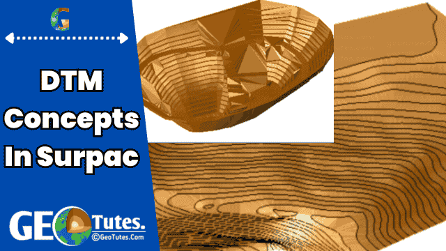
    7. Surface Modeling and Topographic Analysis

    Practical Use Case: Terrain Analysis

    • Process:
      • Import survey data (e.g., GPS points or point clouds).
      • Generate a digital terrain model (DTM).
      • Create contour maps and slope analyses.
    • Applications:
      • Plan infrastructure like roads, drainage, or tailings dams.
      • Analyze slope stability for pit designs.
    • Outcome:
      • High-resolution surface models for engineering and environmental planning.

    Example: A copper mine uses Surpac to assess slope stability for its waste dump design.


    8. Data Visualization and Reporting

    Practical Use Case: Reporting for Stakeholders

    • Process:
      • Visualize 3D models of ore bodies, drillholes, and mine layouts.
      • Generate annotated cross-sections, plan views, and isometric views.
    • Applications:
      • Present project data to stakeholders for decision-making.
      • Prepare reports for compliance with regulatory bodies.
    • Outcome:
      • Professional and informative graphical outputs.

    Example: A zinc mining project generates 3D visualizations of ore bodies to present resource estimates to investors.


    9. Real-Time Survey Data Integration

    Practical Use Case: Mine Monitoring

    • Process:
      • Import real-time survey data (e.g., from drones or total stations).
      • Compare as-built conditions to mine plans.
    • Applications:
      • Monitor progress against schedules.
      • Detect deviations in excavation or construction.
    • Outcome:
      • Improve operational efficiency and reduce rework.

    Example: A coal mine uses drone surveys to monitor pit progress and update its mine plan in Surpac.


    10. Environmental and Rehabilitation Planning

    Practical Use Case: Post-Mining Land Use

    • Process:
      • Use historical survey data and surface models to plan rehabilitation.
      • Simulate landform reconstruction.
    • Applications:
      • Design tailings dam covers or backfilling strategies.
      • Ensure compliance with environmental regulations.
    • Outcome:
      • Sustainable closure plans for mined-out areas.

    Example: A diamond mine uses Surpac to design a rehabilitated landscape post-mining.


    Summary of Benefits in Practical Applications

    • Precision: Accurate modeling and analysis reduce errors in planning.
    • Efficiency: Automates processes, saving time and resources.
    • Integration: Supports data from various sources (LiDAR, GPS, GIS, and drillholes).
    • Compliance: Helps meet regulatory and reporting standards.
    • Visualization: Enhances understanding and communication of complex geological and mining data.

    By leveraging its advanced tools, Surpac ensures optimal results in exploration, design, and production workflows across mining projects.

    In adition to this you can learn and research about the case studies and real life application of such through internet or we also have an article on that. Go and find out more about that from our website.

    In conclusion, integrating point cloud data from drone and 3D laser surveys into Surpac significantly enhances the accuracy and efficiency of geological modeling, mine planning, and surveying, making it an invaluable tool in modern mining and construction industries.

  • What Are The Different Types     Of Variograms Used In Surpac

    What Are The Different Types Of Variograms Used In Surpac

    A variogram is a tool used in geostatistics to analyze and describe how data changes or varies across a certain distance in space. In this article we will learn deeply about What Are The Different Types Of Variograms Used In Surpac. It’s particularly useful in fields like mining, geology, and environmental science, where understanding spatial relationships between points (like rock samples, soil measurements, or mineral content) is important. Here’s a step-by-step breakdown of what Types Of Variograms Used In Surpac and how they work.

    1. Understanding Spatial Dependence

    • Imagine you have samples of gold content taken from different locations in a mine. Usually, points that are closer together will have similar values because they’re in the same environment. As points get farther apart, their values tend to be less similar.
    • This relationship — how similarity decreases with distance — is called spatial dependence. Variograms help us measure and understand this spatial dependence.

    2. How Variograms Work

    • A variogram is a graph that shows how the differences (or variance) between sample values change as the distance between those samples changes.
    • On a variogram graph:
      • The x-axis represents the distance between points (called lag distance).
      • The y-axis represents the measure of difference (called semivariance) between the points.
    • To create the variogram, we calculate the semivariance for multiple pairs of points at different distances and then plot these values.

    3. Parts of a Variogram

    • Nugget: This is the initial value where the graph starts, close to zero distance. It represents measurement errors or variations at very small scales.
    • Sill: The sill is the point on the y-axis where the variogram levels off, meaning the differences in values don’t increase much beyond this point.
    • Range: This is the distance on the x-axis where the variogram reaches the sill. Beyond the range, points become spatially independent, meaning they no longer influence each other.

    4. Why Variograms Matter

    • Estimating Resources: In mining, variograms help geologists estimate the amount of a mineral in unexplored areas based on sample data from known locations.
    • Creating Block Models: By understanding spatial dependence, we can predict values in unmeasured areas to create 3D block models for resource estimation.
    • Improving Sampling Plans: Variograms can guide where to take more samples to reduce uncertainty and improve the accuracy of the model.

    5. Types Of Variograms Used In Surpac

    • Experimental Variogram: Created by plotting the calculated semivariances for actual data points.
    • Theoretical Variogram: A mathematical model fitted to the experimental variogram to predict values for different distances, helping to generalize the spatial relationship.

    In short, a variogram is a powerful graph that shows how similar or different values are across distances. It’s like a guide that helps scientists make sense of patterns underground, improving the accuracy of predictions and the efficiency of mining plans