
Surpac, is a comprehensive geology and mine planning software used widely in the mining and exploration industry. One of its core concepts is DTM (Digital Terrain Model), which is essential for modeling surfaces, volumes, and geological features. Here’s an in-depth explanation of DTM concepts in Surpac.
What is a DTM (Digital Terrain Model)?
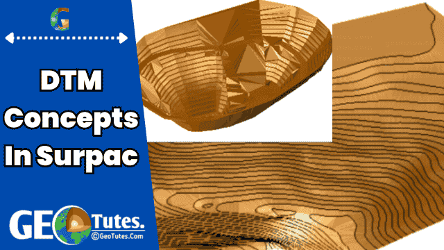
A Digital Terrain Model (DTM) is a mathematical representation of the Earth’s surface, terrain, or other spatial surfaces in 3D. In mining, geology, and civil engineering software like Surpac.
Key Characteristics of a DTM
- 3D Representation: DTMs provide a 3D view of a surface, including elevations, to accurately model topography and other spatial features.
- Triangulation: The surface is built using a network of triangles, created by connecting 3D points (vertices).
- Surface Modeling: Used to model both natural and artificial surfaces, such as:
- Land topography
- Pit designs
- Waste dumps
- Underground structures
How DTMs Work
- Input Data: A DTM is created using spatial data, such as survey points, polylines, or contours.
- Triangulation: The software connects these points into a triangular network using a Triangulated Irregular Network (TIN) method.
- Surface Generation: The resulting surface represents the terrain or feature of interest.
Benefits of Using DTMs
- Accurate Representation: DTMs provide precise spatial information about surfaces.
- Analysis: Enable volume calculations, slope analysis, and visualization.
- Efficiency: Automated tools streamline the creation and manipulation of surfaces.
Challenges
- Data Quality: Inaccurate or sparse input data can lead to errors in the DTM.
- Complexity: Modeling highly detailed or intricate surfaces requires advanced tools.
- Validation: Ensuring the model is error-free (e.g., no duplicate points or dangling edges).
Here are some deep dive into the DTM concepts in Surpac related field.
1. DTM Concepts in Surpac
A DTM (Digital Terrain Model) is a triangulated surface representation of spatial data, typically used to model terrain or geological surfaces. It consists of a network of triangles that are formed by connecting points and lines in 3D space. These models are fundamental for representing the topography of land, ore bodies, pit designs, and more.
2. Components of a DTM
A DTM in Surpac is composed of:
- Vertices (Points): 3D points with X, Y, Z coordinates.
- Edges (Lines): Straight lines connecting the vertices.
- Triangles (Faces): Triangular facets formed by connecting three points.
3. Types of DTM Surfaces in Surpac
- Topographical Surface: Represents the natural ground surface.
- Pit or Dump Surface: Created to represent mining pits, waste dumps, or stockpiles.
- Geological Surfaces: Used to model strata, faults, or ore body outlines.
- Underground Surfaces: Represent underground workings like drifts and stopes.
4. How to Create a DTM in Surpac
A DTM can be created using the following methods:
- From Points:
- Select a set of 3D points with X, Y, Z coordinates.
- Use the “Create DTM from points” tool in Surpac.
- From Polylines:
- Use closed or open polylines to form triangulated surfaces.
- From Data Files:
- Import external data (e.g., CSV, DXF) and use it to create DTMs.
- From Multiple Surfaces:
- Combine two or more DTMs into a single DTM by merging or clipping.
5. DTM Operations in Surpac
Surpac allows a variety of operations on DTMs:
- Editing: Modify existing triangles, add or remove vertices, adjust elevations, etc.
- Merging: Combine two or more DTMs into one.
- Clipping: Trim or split a DTM using boundaries or other DTMs.
- Validation: Check for errors like duplicate points, dangling edges, or inconsistent normals.
- Calculation: Compute volumes, areas, or generate contours.
- Smoothing: Improve the visual and analytical quality of a DTM.
6. Applications of DTMs in Surpac
DTMs are central to many workflows in Surpac, such as:
- Surveying: Modeling topography and terrain changes.
- Mine Design: Creating pit shells, waste dumps, and underground layouts.
- Geological Modeling: Representing ore body geometry or fault planes.
- Volume Calculations: Estimating material quantities for pits, dumps, and stockpiles.
- Analysis and Visualization: Rendering realistic 3D views of terrain and geological features.
7. Best Practices for Working with DTMs
- Ensure Data Quality: Use accurate and dense point data to create DTMs.
- Validate DTMs Regularly: Check for errors and inconsistencies after creation or editing.
- Use Appropriate Boundaries: Define clear limits when creating or clipping DTMs.
- Maintain Proper Layering: Organize DTMs into layers for efficient management.
8. Tools and Functions Related to DTMs in Surpac
Some commonly used tools for DTM management in Surpac include:
- Create DTM: To generate a new DTM.
- Edit DTM: For modifying existing DTMs.
- DTM Calculations: Compute areas, volumes, or intersections.
- Combine DTMs: Merge, subtract, or intersect multiple DTMs.
- DTM Validation: Check and fix errors in the model.
- DTM to Grid Conversion: Convert DTMs to grid files for contouring and other analyses.
9. Challenges in DTM Handling
- Data Gaps: Missing or sparse data can lead to inaccurate models.
- Complex Surfaces: Handling intricate geological structures may require advanced tools.
- Processing Time: Large datasets can increase computational demands.
10. Advanced Features
- Dynamic DTM Updates: Automatically adjust DTMs based on new data.
- Automated Processes: Use macros or scripts for repetitive tasks.
- Integration with Other Modules: Combine DTM analysis with block modeling, resource estimation, and other Surpac tools.
Understanding DTM concepts and tools in Surpac is crucial for effective mine planning and geological analysis.
References:
- https://www.slideshare.net/slideshow/1summery/82674725
- https://ijcrt.org/download1.php?file=IJCRT2202112.pdf
- https://1library.net/article/dtm-dtm-intersections-surpac-dtm-surface-tutorial.yrgjr88q
- http://www.surpac.co.za/wp-content/uploads/2019/05/SURPAC-Topographical-Module-Applications.pdf